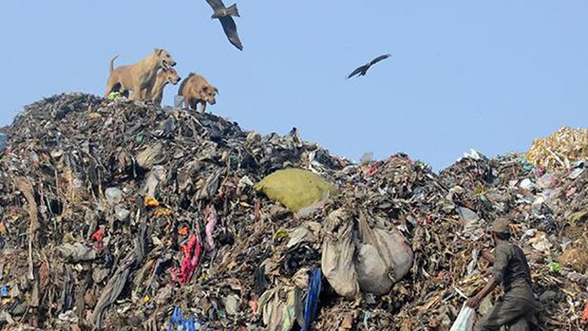
What fuels landfill fires and is 84 times more potent than carbon dioxide over a 20-year period? The answer is methane. While it is an excellent fuel for kitchen stoves, CNG vehicles, and power plants, it is also busy burning the planet. Methane is generated naturally by decomposing organic matter. The same prehistoric processes that created natural gas reserves are now at work within landfills. Managing methane means not just cleaner cities but also a significant step toward our climate ambitions.
Around 15% of India’s methane emissions are from the waste sector. Unlike the agriculture or energy sectors, which require complex, long-term reforms, waste management offers immediate gains through targeted action. Crucially, the policy frameworks and incentives are already in place through national programmes such as the Swachh Bharat Mission.
Targeted action is only possible if we know exactly where the hotspots are, but tracking an invisible gas is difficult. Historically, we have relied on models that estimate emissions by tracking incoming waste volumes and applying baseline assumptions. However, this approach depends on accurate, recurring data, which is often scarce in developing countries. Because such data are aggregated at the regional or national levels and updated infrequently, it makes pinpointing individual sources nearly impossible.
The alternative is physical monitoring, which is even more challenging in the Indian context. Ground-level detection requires expensive equipment, regular maintenance, and constant oversight, making it logistically and technically difficult to scale.
As technology advances, satellites are stepping into this gap. This data broadly fall into two categories: regional measurements that monitor methane over a few kilometers (frequent and useful for national trends), and fine-resolution detection that can pinpoint hotspots down to a few square meters (critical for targeted action).
Satellite data
India has already taken the first steps toward this opportunity. Last year, a paper published by scientists from ISRO quantified anthropogenic methane emissions across the country using satellite data that was acquired in 2023. Based on these measurements, the study identified major dumpsites in Pirana (Ahmedabad), Deonar and Kanjurmarg (Mumbai), and a sewage outlet as significant emitters. The National Green Tribunal took these findings further, establishing a committee to conduct ground investigations at the flagged sites.
Over the past few years, multiple new satellite missions have emerged, such as CarbonMapper’s Tanager and the Space Research Organisation Netherlands (SRON) projects. These satellites provide public data covering major landfills across the country, including Ghazipur and Okhla in Delhi, Jawaharnagar in Hyderabad, and Dhapa in Kolkata. Platforms such as ClimateTRACE and WasteMap collate this global monitoring data, combining it with baseline statistics for advanced modeling. These newer models refine traditional calculations by integrating real-time satellite observations and updating landfill-specific estimates to reflect reality.
Globally, satellite surveys estimate that actual landfill emissions can exceed model-based predictions by around 1.8 times. In India, city-level comparisons are difficult due to a lack of granular data on waste characteristics. Consequently, we must rely on State-level estimates from 2018 for sector-wise breakdowns, as newer public data have not yet been compiled. This discrepancy between advanced satellite observations and older State models highlights a critical information gap: we currently cannot agree on the true scale of the numbers or the location of the hotspots.
Differing data
Take Delhi as an example: its 2018 emissions inventory estimates 1.07 million tons of CO2 equivalent annually from the entire solid waste sector. Recent satellite observations, however, estimate emissions from just Ghazipur and Bhalswa alone to be between 0.85 and 0.96 million tons — almost as much as the sector’s entire theoretical footprint. In Mumbai, the data offer a different perspective. While calculations suggest that the Kanjurmarg landfill accounts for 11% of the city’s waste emissions, an expected number given its engineered design. However, satellite data show it to be emitting 1.05 million tons. This is almost 10 times the model’s estimate and approximately half of the entire State’s solid waste emissions. A similar discrepancy emerges in Gujarat: the state estimates 0.73 million tons for the entire sector, satellite observations show the landfills in Surat and Ahmedabad alone emitting between 0.60 and 0.81 million tons.
These are not just numbers. They indicate potential leakages, accelerated methane generation, or opportunities to refine our engineered systems.. Critically, these are hazards we never tackled simply because we did not know they existed. Now, we can not only gauge the magnitude of the problem but, in the case of large landfills, also pinpoint the exact source of the leaks, allowing for precise, targeted solutions.
Of course, these observations come with limitations. Cloud interference and complex weather dynamics mean that satellite data cannot fulfil its potential in isolation. Urban local bodies must complement these findings with ground-level insights, a step that is especially critical for the massive, unwieldy landfills of our metro cities. The real breakthrough lies in linking satellite detection with ground-level action.
Feedback loop
When satellites detect a methane hotspot, ground teams can immediately investigate the cause — whether it is poor waste coverage, a gas collection failure, or illegal dumping. This creates a powerful feedback loop: space-based detection guides targeted ground interventions, while ground data validate and improve satellite accuracy. Integrating other data sources beyond just methane monitoring can further enhance the efficiency of this loop.
At open dumpsites such as Ghazipur, recording dumping and reclamation patterns provides critical insight into how human activity drives methane generation. Meanwhile, at engineered landfills such as Jawaharnagar and Kanjurmarg, infrastructure data on existing gas collection systems can help pinpoint leaks and identify hidden hotspots. Cities such as Bengaluru, with their advanced waste management systems, are well-positioned to integrate these datasets to increase transparency.
To address this, we need coordinated action on three critical fronts: expanding satellite monitoring to cover all major waste sites, establishing on-ground validation systems in metro cities, and creating standardised data-sharing protocols between urban local bodies and oversight agencies.
Currently, urban local bodies operate in silos, separate from the State Pollution Control Boards that oversee them. This disconnect hinders coordinated action on methane reduction. However, the revised municipal waste guidelines already envision a centralised data portal for bulk waste management, handling the wet waste that is the primary source of untreated methane. This portal could be expanded to connect with a standardised nationwide dataset for tracking emissions. Regional bodies such as the Commission for Air Quality Management (CAQM) in the NCR can oversee this monitoring, while the Swachh Bharat Mission can integrate methane targets, aligning them with other central schemes.
This integrated approach delivers multiple co-benefits that make the investment worthwhile. Methane’s potential as a fuel is already recognised in policy. Just recently, Indore has utilised the Gobardhan scheme to set up a Bio-CNG plant from its waste.
This strategy creates a powerful ecosystem: satellites detect hotspots, ground teams investigate and fix leaks, and standardised data sharing ensures insights reach decision-makers instantly. What is needed now is coordinated implementation across these three fronts. By making data the backbone of our waste policy, we can turn one of our biggest environmental challenges into our smartest climate solution.
Suyash Nandgaonkar is a Senior Research and Policy Associate at the Energy Policy Institute at the University of Chicago (EPIC India)
Published – December 16, 2025 07:00 am IST